#geographyinaction
-

GIS Design & Development
Since 1999 THM has carried out advanced GIS and designed innovative GIS processes, utilising Python and data techniques. Skilled in design and implementation alongside understanding the ethics of GIS data collection and analysis.
-

Wild East & NE
Dec 2022 - April 2023
In a project mapping ecological connections between two parishes, citizens were taught how to map and identify opportunities to improve biodiversity.
-

Visualising Space for Nature
2020 - CURRENT
Providing innovative support to the Wild East project - a group of landowners determined to encourage people to make space for nature and plot that nature on a map.
-

MCE mapping
2020 - CURRENT
Multi-criteria evaluation is used to predict potential peat landslide risk in onshore wind farms and to identify areas for optimum development offshore.
-

CastCO Monitoring
2022 - CURRENT
How can citizen scientists get involved when they live too far from the study site? By providing GIS and data support to the CastCO team so project funds can be spent on kit!
-

Gaywood GIS
2011 - CURRENT
Begun in 2011 the Gaywood GIS has become increasingly relevant recently providing an unbiased baseline, location of issues and visualisation of potential solutions.
-

Slow Ways
2020 - 2022
Beginning as a volunteer and then as Geospatial contact multiple GIS analyses were carried out in ESRI & QGIS to optimise the Slow Ways datasets
-

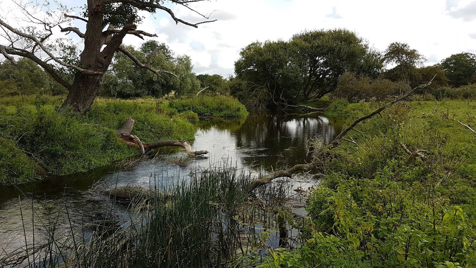
LIDAR & Transects
2022
A river restoration within a heavily managed floodplain required LIDAR mapping and interpretation to find the old braided channels and identify historic artefacts.
-

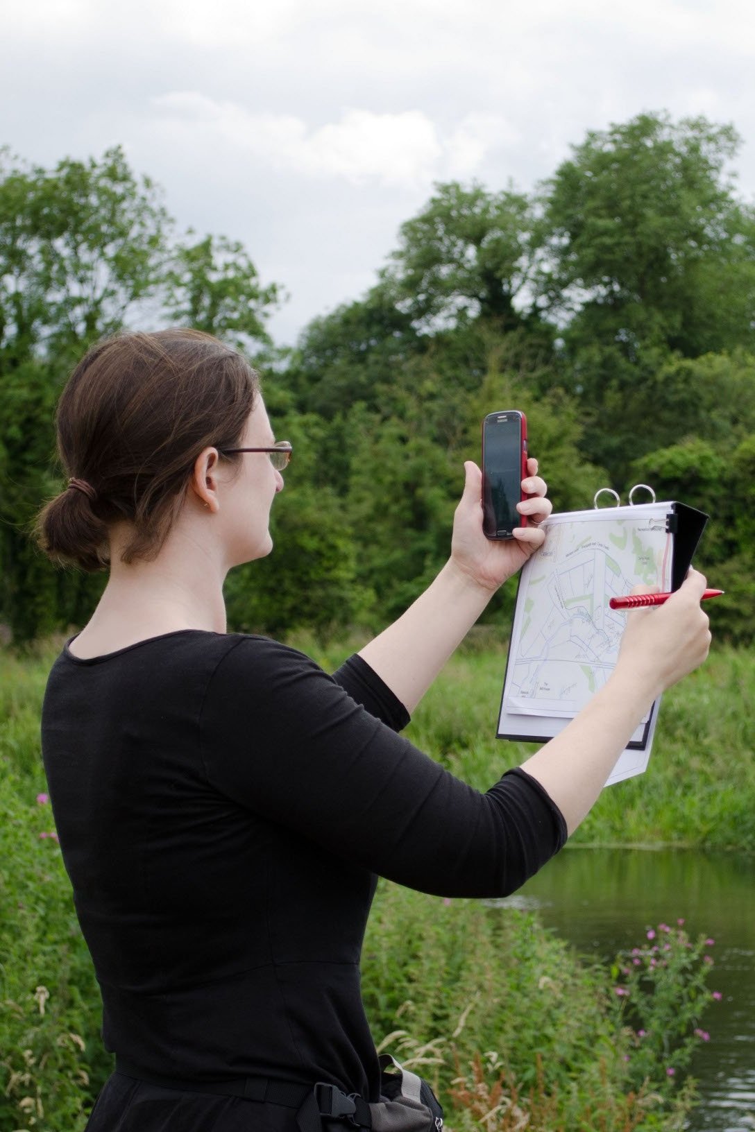
River Surveys
2017 - CURRENT
Following MorPH training in 2017 many surveys were carried out before and after projects, often volunteering time to NRT projects as a second on-site for H&S reasons.
-

NFM
2017-2019
Partnership working on Natural Flood Management Defra pilot (EA/BA) with baseline morphology assessments using MorPH, fixed-point photography, drone surveys and data management.
-

Green Networks
2015-2017 (ESRC)
Developing a regional green space infrastructure from a combination of open street map and open source data to establish the first regional green spaces map.
-
RiverEYE
2014 (PhD)
What are the barriers to adopting citizen science in river monitoring? What are the pros and cons, are organisations prepared for the disruptive influence and how can communities ensure their data is compliant?
-

Catchment Modelling
2014 (PhD)
Building on the Stiffkey work the GIS process was replicated in another chalk catchment, but stakeholder buy-in was limited by a lack of landowner engagement and limited funds to make on the ground changes.
-

Stiffkey Visioning
2013 (PhD)
We know communities find visualisations useful but why do they take so long to develop? What about short-term small-scale landscape projects? Is there a faster way? What are the barriers to adoption?
-

Catchment GIS
2012 (PhD)
Building on the VesAR project GIS analysis was carried out to establish whether ecological gaps could be automatically identified and a future vision created at a catchment scale. Pilot for Stiffkey Visioning.
-
VeSAR
2011/2012 (PhD)
Augmented Reality is often used as gimmick or in gaming, but what if it could be used to show the building blocks of the landscape? Can ecosystem services within a catchment be communicated in more interactive ways?